Wianamatta rising: charting the future of a Western Sydney waterway
By Scott Davies, Hassell Senior Associate
Sydney is a city that’s not just shaped by water – it’s renowned for it. Not surprisingly, the spotlight is often on the celebrated Sydney Harbour in the city’s east, or its main tributary, the Parramatta River, in the central part of the city. But water also plays a critical role in Sydney’s west, even if it’s in more subtle ways.
The fast-growing region is home to the longest freshwater stream in Greater Sydney – Wianamatta, or ‘the Mother Place’, to the Darug people who lived on the surrounding lands before Australia’s colonisation.
Running some 80 kilometres through the heart of Western Sydney, Wianamatta is a defining feature of this large, flat floodplain. Yet it had been almost forgotten – a shadow of its former self – until recently.
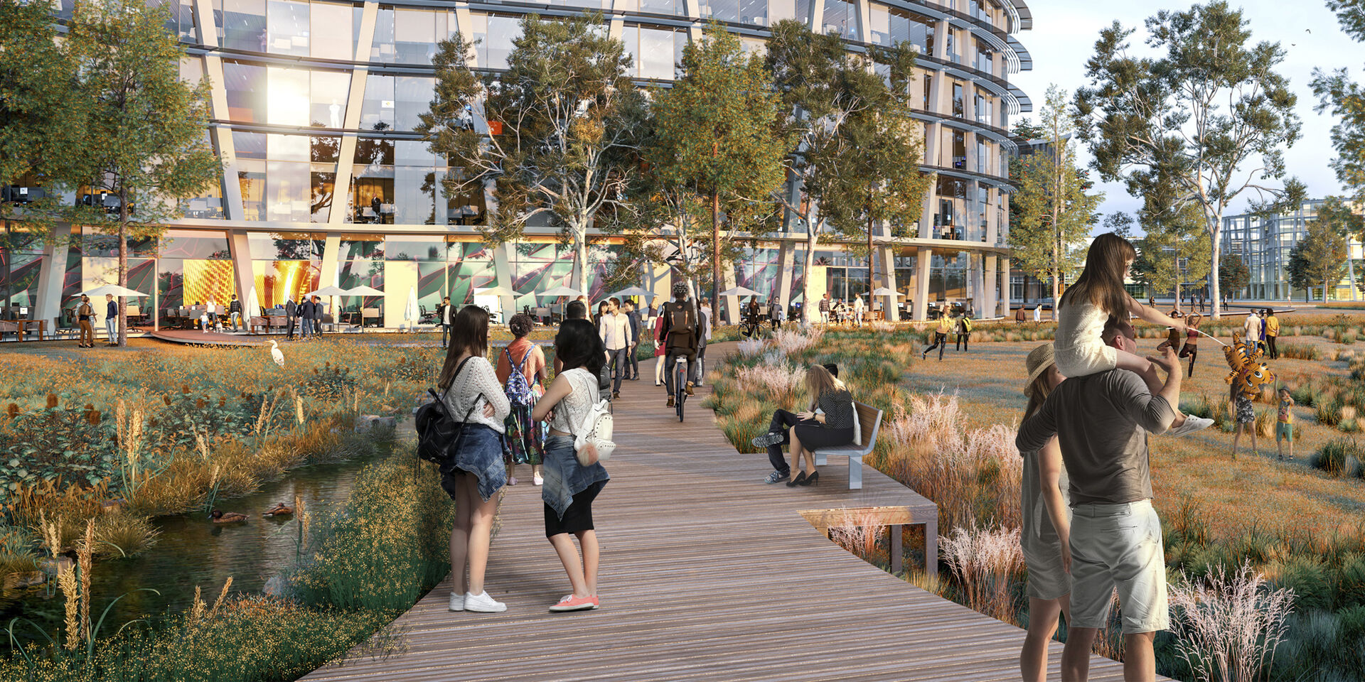
Development of a new economic centre for the region – Aerotropolis, located near the new Western Sydney International Airport – has brought Wianamatta back into focus.
It’s part of a broader shift toward landscape-led urbanism in many global cities, with waterway health at the centre of the conversation. With our climate at tipping point, urban designers are looking for ways to foster resilience on projects that, like Aerotropolis, have the potential to make a lasting, positive impact on both people and planet.
By listening to and learning from the First Peoples to live on the land, designers involved in the project – including Hassell – are also building a greater understanding of Country, drawing on the knowledge of the past to contribute to a more sustainable future.
THE DAMAGE DONE – AND HOW TO REPAIR IT
Wianamatta has a catchment that’s actually larger than Sydney Harbour, winding its way from south to north before it eventually joins with the Hawkesbury River. And with thousands of ephemeral tributaries, this waterscape (including Cumberland Plain) is integral to the landscape, so it should shape (rather than be shaped by) human settlement.
The need is becoming increasingly urgent. With a rapidly changing climate, the whole world is experiencing the impact of human activity on our planet. At a local scale in Western Sydney, this means extremely hot summers, bush fires, more severe storm events and flooding.
In January 2021, Western Sydney was the hottest place on Earth, according to the Climate Council. Just over a year later, it was engulfed by flood waters.
Right now, the Wianamatta-South Creek catchment is the most degraded in the Hawkesbury-Nepean River system due to historical vegetation clearing and urbanisation (Aerotropolis Precinct Plans, 2020, DPIE Environment, Energy and Science Group).
There’s a long history of those practices, which comes through clearly in an 1827 excerpt from Benson and Howell’s Taken for Granted, The bushland of Sydney and its suburbs (Kangaroo Press, 1990). Peter Cunningham wrote of Western Sydney and its Cumberland Plain:
“Beyond this commences a fine timbered country, perfectly clear of bush, through which you might, generally speaking, drive a gig in all directions, without any impediment in the shape of rocks, scrub or close forest.”
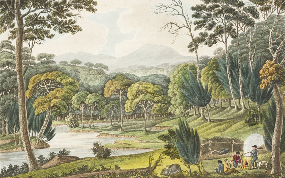
Well before British colonisation, there was active management of this open, woodland landscape, yet in very different ways.
In her role shaping precinct planning for Aerotropolis in 2020, Dr Danièle Hromek of cultural design and research practice, Djinjama, noted that the area’s First Peoples regularly shaped the character of the land, sometimes through dramatic measures:
“Cool burns managed the chance of bushfires, now prevalent in warmer parts of the year. Songs and stories tell the right time for firestick farming.”
These practices mitigated the risk of fire in hot summers on the Cumberland Plain, and they fostered a richer environment for sourcing food, such as the aptly-named Emu Plains of Western Sydney.
AN ENDURING CONNECTION TO WATER
It appears the area’s watery landscape also made a strong impression on outsiders arriving in colonial times.
In 1822 Baron Field (in Benson and Howell, 1990) called Western Sydney’s Hawkesbury-Nepean river “the Nile of Botany Bay”, adding that “its banks owe their fertility to the floods which come down from the Blue Mountains, and which have been known to swell the waters nearly a hundred feet (30 metres) above their usual level.”
To the area’s First Peoples, the waters are revered and all-encompassing, as Dr Hromek points out:
“The waters in Wianamatta are sacred from the Dreaming, they are also all interconnected…The waters shaped the (Sydney) basin, from small creeklets up to larger pools and rivers, to the massive regular floods.”
Further to this, she notes that resolutions on the protection of Country – made between Aboriginal Elders in the 1820s – need to be upheld even today.
Importantly, in looking at Western Sydney generally and Aerotropolis specifically, Dr Hromek has highlighted water’s particular significance to women:
“Women have strong enduring relationships with water, from creating watery spaces within their bodies to grow life to having reciprocal care relationships with landscapes of water. Women and their roles in the cycle of life should be honoured in this place.”
A BLUEPRINT FOR ‘CONNECTING WITH COUNTRY’
These powerful connections and sense of place come from a deep understanding of and connection to this land, and only Aboriginal and Torres Strait Islander peoples can speak for Country. Their voices are guiding the design of Aerotropolis and informing all the objectives of the greater plan.
The Connecting with Country Framework (2020) from the Government Architect of New South Wales (GANSW) informs the planning, design, and delivery of built environment projects in the state.
This approach has influenced how we’ve come to design and care for urban landscapes – where we listen to Country and learn from it to inform design choices.
On Aerotropolis, this has spatially translated into:
- Using water as a structuring system for the precincts
- Protecting ridgetops and creek lines as open space and landscape
- Arranging street and urban patterns to visually and physically connect high and low points of topography as well as vegetation with water
- Providing a visual connection between sky, vegetation, land form and landscape.
Following this approach, we’ve embedded both landscape and waterscape in the urban framework, making them an intrinsic part of Aerotropolis.

FROM A SMALL CREEK TO A WHOLE PRECINCT
Precinct-scale water quality management
Waterway health is integral to the landscape-led urbanism of Aerotropolis. On the project, we’re approaching water by:
- Arranging the urban structure so that ephemeral creeks, selected farm dams and water dependent ecosystems are protected and connected
- Slowing down and retaining water within the urban areas to avoid damaging storm water flows into the Wianamatta system
- Retaining water in the urban landscape through trunk drainage in streets and areas of open space with a range of water sensitive urban design techniques, including ‘riparian boulevards’, retention basins and detention basins in parklands.
Landscape-led urbanism also extends to urban repair. And on Aerotropolis that means restoring and enhancing waterways and their riparian corridors.
After consultation with community and stakeholders, we moved to retain all creeks and riparian corridors from Strahler level 3 and above within open space. This allows for eventually transferring the major and intermediate corridors to public ownership and management. Open space, active transport corridors and drainage management systems will be integrated with these riparian corridors.
We may modify minor ephemeral networks below Strahler level 3 while still upholding their functional role within the urban landscape. To do that, ‘riparian boulevards’ are a fundamental part of the Aerotropolis plan. They provide plenty of space within public road reservations for drainage and riparian functions, but in an altered state suited to integrated urban development.
Flood management
The flood management approach across Aerotropolis revolves around:
- Containing urban development outside of the 1% annual exceedance probability (AEP) area – an approach that’s consistent with State policy and ensures we avoid blockages in major estimated flow areas
- Allowing for some areas of passive recreation in low risk flood areas, including footpaths and similar lower-cost infrastructure
- Locating recreation areas and associated zones that may be used for emergency management outside the 1% AEP to enhance urban resilience.
This has significant benefit for environmental repair of the Wianamatta system, as well as offering urban cooling potential.
THE FUTURE IS…NOW
These and other measures demonstrate why Aerotropolis represents a new way of planning and designing cities – one that’s even more critical given the increasing challenges of climate change.
With a sharp focus on water and the environment on the project – and a dedication to designing for Country by listening to those who know it best – urban designers are contributing to a more sustainable, resilient way of living in Australia.
And through each experience we have like the one in Western Sydney, we become more steadfast in our belief that true landscape-led urban design can repair cities not just here but around the world.